‘To GPS, or not to GPS’ - Recalculating Navigation
Written by Janelle White

People want maps for decoration, for information, and for inspiration. Maps are symbols, and symbols are powerful. … (Also), a map doesn’t run out of batteries.
(Brad Green, owner of World of Maps, Ottawa; cited in CBC article, 11.06.2023: Is Map-reading a lost art?)
The physical map (perhaps) has the same appeal as the vinyl record. It’s tactile, it’s there, it’s present – it’s not ephemeral.
(Georges Bevan, Assoc Prof Geography and Planning Queen’s Uni, Kingston, Ontario; cited in the aforementioned CBC article)
A fairly recent newcomer to Perth/Fremantle and surrounds, I rely on map memory to follow routes based on the number of main roads, names and recognisable landmarks. I figure it’s doing me good. To date, I’ve only overshot my destination once – on International Women’s Ride Day, when I missed the group ride because I rode to Yanchep, instead of Mirrabooka…
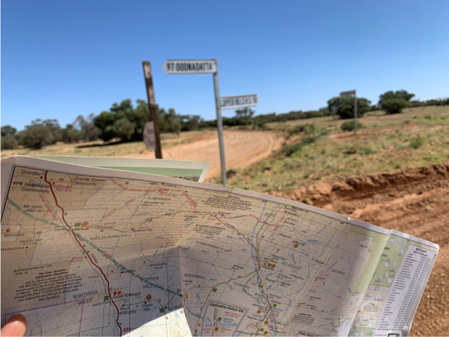
Despite the occasional lapse, I like to think that my sense of direction is well-honed. Having spent years taking part in orienteering and rogaining events, (including inadvertently representing Australia in a Mountain Bike Orienteering event against New Zealand…which New Zealand won)* I rather enjoy the art of map reading. Paper maps in particular have an ability to ensnare my interest for hours, offering roads for riding, contours for climbing, towns for visiting, and areas for skirting.
Brought up speaking ‘paper map’, what happens when the language changes? When digital global reference and positioning systems, including the voice of Siri or Google Maps, decides… and becomes ever more powerful in navigating through terrain to specific points, berating when you make a so-called wrong turn?!
The Luddite in me rebels, asking what of the context? The geography? Maps orient in relation to surrounds. How do I similarly interpret the isolation of a GPS location, where a simple blue dot focuses on the ‘here’?
* ‘Inadvertent’ due to my name being put forward by default, purely because I’d entered all three distance events.

(20 years ago)
We’re standing atop a quartz outcrop, scanning the spinifex covered plains and hills to the south. A Pitjantjatjara Elder stands beside me. He’s climbed this hill to help me navigate the socio-cultural landscape surrounding us. We’re in the Anangu Pitjantjatjara Yankunyjatjara lands of north-west South Australia, and it is at this moment that I realise the immensity of the extent to which we humans can differ in our understanding and interpretation of our sense of place. The Elder explains that the hills are ancestral beings who have come to this place to sort a disagreement. Their tails thrash as they fight, flattening the land between them, forming the plain. The ancestral presence is alive, continuing to enliven and enrich this Country. I am truly honoured to be privy to such knowledge and to engage in experiences that allow me insight into the mind-maps of other cultures, other ways of being and seeing.

Maps as story, song, and dance. Visualising, navigating, experiencing and intimately understanding a place. Foot-walking, feeling, experiencing, sensing a place. Following instincts, being guided by experience; tracks in the sand, skills for survival. The wisdom of ancestral paths, locating us in time and space.
Maps as an aide-memoire, …but whose memories are championed? (And) whose are suppressed or forgotten? I ponder the power in claiming, creating and (re)interpreting space. While reciprocity underpins Indigenous modes of Caring for Country, Cartesian principles and practices, symbols and naming conventions often capture but a moment in time and often reflect dislocation, discombobulation (including ‘geographical embarrassment’ – aka. getting lost), unfamiliar territory, or simply the mundane: Mt Disappointment, Mt Nameless, Cheese Tin creek, …to mention but a few.
But, as anthropologist Keith Basso writes, ‘Wisdom Sits in Places’. Reflecting on the Western Apache practice of repeating place-names spoken by ancestors, Basso researched how these names described and provided pictures of places that aided in navigating landscapes. I’m reminded of the Aboriginal songs and stories that provided crucial information for way-finding through the remote Australian outback, to survive where essential life-giving resources often remained hidden to the uninitiated. What happens if you find yourself in an unfamiliar landscape? That’s when you rely on instincts honed through knowledge shared across generations. Such navigation depends on spending time listening to Elders, learning, and ultimately, respect. It’s a privileged and humbling experience to spend time working in this space.

Map of Ancestral travels by Barbara Sturt (Crocodile and Goanna)
I’ve heard talk of a navigational gene, as well as gender differences that reportedly involve a penchant for holding maps upside-down… Personally speaking, I prefer mud maps drawn with a stick at the side of the road, and often accompanied by helpful guesstimations of distance – (including my all-time favourite: ‘little bit long way’, which turned out to be about 60kms). Then there was that time, years ago, I remember being mesmerised in the basement of a Venetian merchant house when I came upon a large canvas displaying an array of metal pins. An artwork from the Venice Biennale, it was a beguiling work of delicate patterns showing the trajectory of a butterfly’s flight. I remember thinking it was one of the most beautiful things I had ever seen. A powerful reminder that we all need navigational skills to help direct our lives, … let alone our two-wheeled companions.
Yes, I like to think that my sense of direction is well-honed. However, there was that one time I managed to ride to the wrong side of a country… But, well, …that’s another story!


Leave a comment